


Lac cornu aller/retour

geoffrayLayeux
User
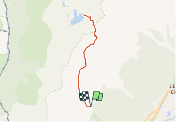

Length
6.9 km

Max alt
2410 m

Uphill gradient
521 m
Km-Effort
13.9 km

Min alt
2016 m

Downhill gradient
521 m
Boucle
Yes
Creation date :
2021-06-04 15:26:22.465
Updated on :
2021-06-04 15:27:51.1
3h09
Difficulty : Difficult

FREE GPS app for hiking
 SityTrail
IGN / Geographical institutes
SityTrail Plus
The world is yours!
About
Trail Walking of 6.9 km to be discovered at Auvergne-Rhône-Alpes, Upper Savoy, Chamonix-Mont-Blanc. This trail is proposed by geoffrayLayeux.
Positioning
Country:
France
Region :
Auvergne-Rhône-Alpes
Department/Province :
Upper Savoy
Municipality :
Chamonix-Mont-Blanc
Location:
Unknown
Start:(Dec)
Start:(UTM)
333573 ; 5089189 (32T) N.
Comments