


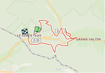
SURCENEUX GRD VALTIN

surceneux
User

Length
8.7 km

Max alt
936 m

Uphill gradient
316 m
Km-Effort
13 km

Min alt
752 m

Downhill gradient
341 m
Boucle
No
Creation date :
2021-06-06 13:10:18.177
Updated on :
2021-06-06 20:01:28.524
2h20
Difficulty : Easy

FREE GPS app for hiking
 SityTrail
IGN / Geographical institutes
SityTrail Plus
The world is yours!
About
Trail Walking of 8.7 km to be discovered at Grand Est, Vosges, Ban-sur-Meurthe-Clefcy. This trail is proposed by surceneux.
Description
SURCENEUX RF MALTETE STRAITURE LA PEUTE BASSE LA BLANCHE FEMME DISQUE BLEU SCHMALICK COL PORT DES PLANCHES GASPARD SURCENEUX
Positioning
Country:
France
Region :
Grand Est
Department/Province :
Vosges
Municipality :
Ban-sur-Meurthe-Clefcy
Location:
Unknown
Start:(Dec)
Start:(UTM)
348031 ; 5329135 (32U) N.
Comments