


2021-06-07 Col de la Loubière

Bernardb44
User
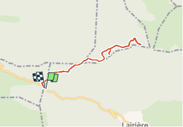

Length
8.4 km

Max alt
745 m

Uphill gradient
235 m
Km-Effort
11.6 km

Min alt
588 m

Downhill gradient
235 m
Boucle
Yes
Creation date :
2021-06-07 09:03:15.902
Updated on :
2021-06-07 12:00:42.282
2h41
Difficulty : Easy

FREE GPS app for hiking
 SityTrail
IGN / Geographical institutes
SityTrail Plus
The world is yours!
About
Trail Walking of 8.4 km to be discovered at Occitania, Aude, Lairière. This trail is proposed by Bernardb44.
Positioning
Country:
France
Region :
Occitania
Department/Province :
Aude
Municipality :
Lairière
Location:
Unknown
Start:(Dec)
Start:(UTM)
455554 ; 4763711 (31T) N.
Comments