


2021 06 06 marseille nogent

hal2012
User

Length
790 km

Max alt
569 m

Uphill gradient
6930 m
Km-Effort
882 km

Min alt
11 m

Downhill gradient
6894 m
Boucle
No
Creation date :
2021-06-07 09:34:43.611
Updated on :
2021-06-07 17:02:34.705
7h26
Difficulty : Very easy

FREE GPS app for hiking
 SityTrail
IGN / Geographical institutes
SityTrail Plus
The world is yours!
About
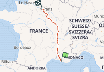
Trail Car of 790 km to be discovered at Provence-Alpes-Côte d'Azur, Bouches-du-Rhône, Marseille. This trail is proposed by hal2012.
Positioning
Country:
France
Region :
Provence-Alpes-Côte d'Azur
Department/Province :
Bouches-du-Rhône
Municipality :
Marseille
Location:
3rd Arrondissement
Start:(Dec)
Start:(UTM)
692611 ; 4797387 (31T) N.
Comments