


Chartreuse Charmant Some par col de la Charmette

c.gourme
User
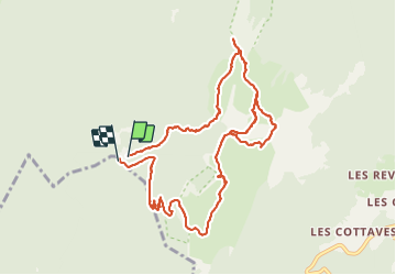

Length
11.8 km

Max alt
1854 m

Uphill gradient
804 m
Km-Effort
23 km

Min alt
1276 m

Downhill gradient
809 m
Boucle
Yes
Creation date :
2021-06-08 06:24:00.0
Updated on :
2021-06-08 13:03:50.137
4h49
Difficulty : Medium

FREE GPS app for hiking
 SityTrail
IGN / Geographical institutes
SityTrail Plus
The world is yours!
About
Trail Walking of 11.8 km to be discovered at Auvergne-Rhône-Alpes, Isère, Saint-Pierre-de-Chartreuse. This trail is proposed by c.gourme.
Positioning
Country:
France
Region :
Auvergne-Rhône-Alpes
Department/Province :
Isère
Municipality :
Saint-Pierre-de-Chartreuse
Location:
Unknown
Start:(Dec)
Start:(UTM)
714841 ; 5022409 (31T) N.
Comments