


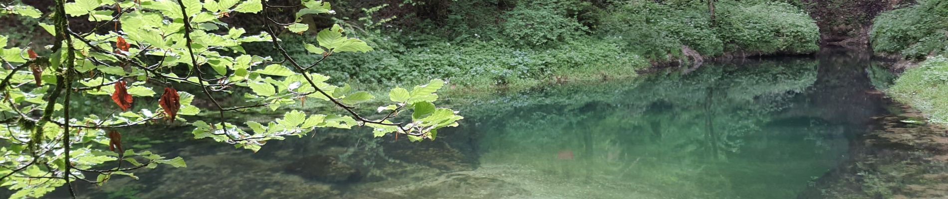
Source de l'Ain

Marie-Claire-mcp
User
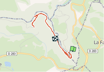

Length
4.4 km

Max alt
744 m

Uphill gradient
121 m
Km-Effort
6.1 km

Min alt
669 m

Downhill gradient
138 m
Boucle
No
Creation date :
2021-06-08 08:44:29.78
Updated on :
2023-09-20 14:37:50.039
1h43
Difficulty : Very easy

FREE GPS app for hiking
 SityTrail
IGN / Geographical institutes
SityTrail Plus
The world is yours!
About
Trail Walking of 4.4 km to be discovered at Bourgogne-Franche-Comté, Jura, Conte. This trail is proposed by Marie-Claire-mcp.
Description
Source de l'Ain
Photos


22 photos in total. Please click on a photo to see them all in the gallery.
Positioning
Country:
France
Region :
Bourgogne-Franche-Comté
Department/Province :
Jura
Municipality :
Conte
Location:
Unknown
Start:(Dec)
Start:(UTM)
272628 ; 5181678 (32T) N.
Comments