


SityTrail - Boucle d'Issus

pidjam
User
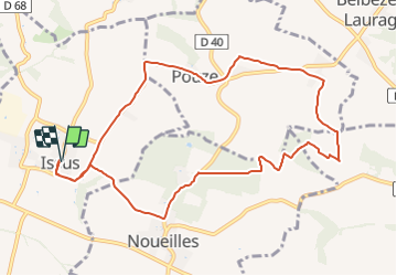

Length
11.2 km

Max alt
272 m

Uphill gradient
212 m
Km-Effort
14 km

Min alt
193 m

Downhill gradient
211 m
Boucle
Yes
Creation date :
2021-06-09 08:00:29.901
Updated on :
2021-06-09 08:04:04.889
3h10
Difficulty : Difficult

FREE GPS app for hiking
 SityTrail
IGN / Geographical institutes
SityTrail Plus
The world is yours!
About
Trail Walking of 11.2 km to be discovered at Occitania, Haute-Garonne, Issus. This trail is proposed by pidjam.
Description
Départ d'Issus, panoramas à 360 degrés par endroit. Randonnée réalisée le 17 avril. Ce circuit emprunte des chemins mais aussi des petites routes avec très peu de circulation, donc à visionner sur le site.
Positioning
Country:
France
Region :
Occitania
Department/Province :
Haute-Garonne
Municipality :
Issus
Location:
Unknown
Start:(Dec)
Start:(UTM)
379058 ; 4808965 (31T) N.
Comments