


Laqueuille seycheuse vassiviere Peyre-Gary

impradine
User

Length
14.2 km

Max alt
1632 m

Uphill gradient
583 m
Km-Effort
22 km

Min alt
1162 m

Downhill gradient
587 m
Boucle
Yes
Creation date :
2021-06-09 08:55:28.0
Updated on :
2021-06-13 13:06:26.134
4h20
Difficulty : Medium

FREE GPS app for hiking
 SityTrail
IGN / Geographical institutes
SityTrail Plus
The world is yours!
About
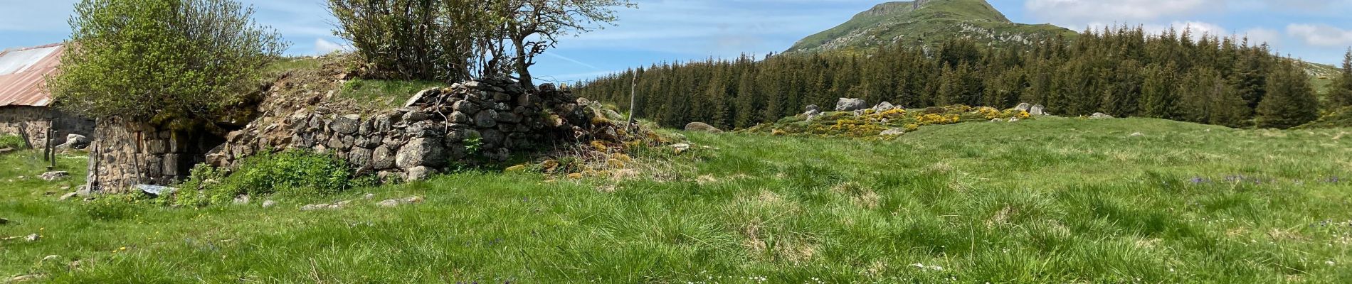
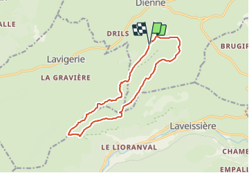
Trail Walking of 14.2 km to be discovered at Auvergne-Rhône-Alpes, Cantal, Dienne. This trail is proposed by impradine.
Photos


Positioning
Country:
France
Region :
Auvergne-Rhône-Alpes
Department/Province :
Cantal
Municipality :
Dienne
Location:
Unknown
Start:(Dec)
Start:(UTM)
483204 ; 4998943 (31T) N.
Comments