


Échelles de la mort

i20
User

Length
13 km

Max alt
998 m

Uphill gradient
584 m
Km-Effort
21 km

Min alt
570 m

Downhill gradient
589 m
Boucle
Yes
Creation date :
2021-06-12 11:31:12.0
Updated on :
2021-06-12 15:42:43.841
3h48
Difficulty : Difficult

FREE GPS app for hiking
 SityTrail
IGN / Geographical institutes
SityTrail Plus
The world is yours!
About
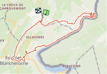
Trail Walking of 13 km to be discovered at Bourgogne-Franche-Comté, Doubs, Charquemont. This trail is proposed by i20.
Positioning
Country:
France
Region :
Bourgogne-Franche-Comté
Department/Province :
Doubs
Municipality :
Charquemont
Location:
Unknown
Start:(Dec)
Start:(UTM)
336557 ; 5227948 (32T) N.
Comments