


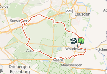
Utrecht - Leuserheideroute

gpstracks
User

Length
34 km

Max alt
46 m

Uphill gradient
208 m
Km-Effort
36 km

Min alt
1 m

Downhill gradient
209 m
Boucle
Yes
Creation date :
2014-12-10 00:00:00.0
Updated on :
2014-12-10 00:00:00.0
--
Difficulty : Unknown

FREE GPS app for hiking
 SityTrail
IGN / Geographical institutes
SityTrail Plus
The world is yours!
About
Trail Cycle of 34 km to be discovered at Utrecht, Unknown, Woudenberg. This trail is proposed by gpstracks.
Description
More information on GPStracks.nl : http://www.gpstracks.nl


Positioning
Country:
Netherlands
Region :
Utrecht
Department/Province :
Unknown
Municipality :
Woudenberg
Location:
Unknown
Start:(Dec)
Start:(UTM)
665555 ; 5772926 (31U) N.
Comments
