


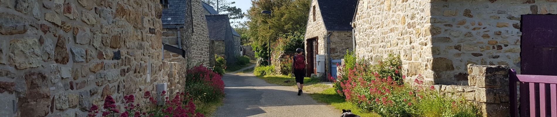
FINISTÈRE- CAP de la CHÈVRE

ffffff
User

Length
13.3 km

Max alt
105 m

Uphill gradient
327 m
Km-Effort
17.7 km

Min alt
18 m

Downhill gradient
327 m
Boucle
Yes
Creation date :
2021-06-14 07:31:48.822
Updated on :
2021-06-14 16:16:24.941
3h30
Difficulty : Easy

FREE GPS app for hiking
 SityTrail
IGN / Geographical institutes
SityTrail Plus
The world is yours!
About
Trail Walking of 13.3 km to be discovered at Brittany, Finistère, Crozon. This trail is proposed by ffffff.
Photos


21 photos in total. Please click on a photo to see them all in the gallery.
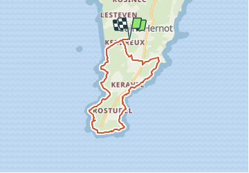
Positioning
Country:
France
Region :
Brittany
Department/Province :
Finistère
Municipality :
Crozon
Location:
Unknown
Start:(Dec)
Start:(UTM)
385729 ; 5339649 (30U) N.
Comments