rando vers le Pic de l'Ours avec Marinette

gillou1947
User
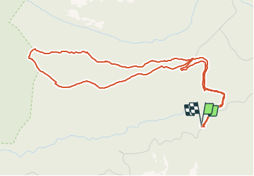

Length
6.2 km

Max alt
294 m

Uphill gradient
159 m
Km-Effort
8.3 km

Min alt
155 m

Downhill gradient
159 m
Boucle
Yes
Creation date :
2021-06-16 07:25:47.621
Updated on :
2021-06-16 09:03:38.305
1h37
Difficulty : Medium

FREE GPS app for hiking
 SityTrail
IGN / Geographical institutes
SityTrail Plus
The world is yours!
About
Trail Walking of 6.2 km to be discovered at Provence-Alpes-Côte d'Azur, Var, Saint-Raphaël. This trail is proposed by gillou1947.
Positioning
Country:
France
Region :
Provence-Alpes-Côte d'Azur
Department/Province :
Var
Municipality :
Saint-Raphaël
Location:
Unknown
Start:(Dec)
Start:(UTM)
330650 ; 4814194 (32T) N.
Comments