


GR_37_AD_18_Maen-Roch_Chatellier_20210617

patrickdanilo
User

Length
17.8 km

Max alt
172 m

Uphill gradient
235 m
Km-Effort
21 km

Min alt
94 m

Downhill gradient
164 m
Boucle
No
Creation date :
2021-06-17 09:40:57.883
Updated on :
2022-02-09 13:48:30.533
4h31
Difficulty : Easy

FREE GPS app for hiking
 SityTrail
IGN / Geographical institutes
SityTrail Plus
The world is yours!
About
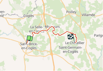
Trail Walking of 17.8 km to be discovered at Brittany, Ille-et-Vilaine, Maen-Roch. This trail is proposed by patrickdanilo.
Description
GR®37
Cœur de la Bretagne
Du Mont-Saint-Michel (Manche) Normandie
à Camaret-sur-Mer (Finistère) Bretagne
780km
Photos


Positioning
Country:
France
Region :
Brittany
Department/Province :
Ille-et-Vilaine
Municipality :
Maen-Roch
Location:
Saint-Brice-en-Coglès
Start:(Dec)
Start:(UTM)
620520 ; 5363476 (30U) N.
Comments