


Le Charmant Som par Le Collet

patjobou
User


6h40
Difficulty : Medium

FREE GPS app for hiking
 SityTrail
IGN / Geographical institutes
SityTrail Plus
The world is yours!
About
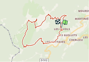
Trail Walking of 12.5 km to be discovered at Auvergne-Rhône-Alpes, Isère, Saint-Pierre-de-Chartreuse. This trail is proposed by patjobou.
Description
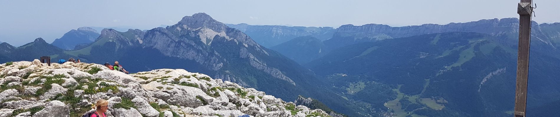
Belle boucle de 12 km. Montée jusqu'au Collet par un sentier bien tracé, en foret. On découvre les paysages pendant la traversée des dalles: Vercors, Chamechaude, dent de Crolles, Lances de Malissard, Grand Som. Montée finale, par le sentier non balisé qui évite la voie normale, fréquentée, qui monte depuis le parking. Retour par la brèche sous l'Oratoire d'Orgeval, par un bon sentier, bien tracé, mais avec des passages 'sportifs'. A éviter par temps humide. Belle balade.
Au point 6km, il exister bien un tracé qui plonge, et qui rejoint rapidement le sangle ouest.
Photos


Positioning
Comments