


SityTrail - Le Bout des Crocs

raymondfn
User

Length
11.9 km

Max alt
26 m

Uphill gradient
99 m
Km-Effort
13.2 km

Min alt
5 m

Downhill gradient
99 m
Boucle
Yes
Creation date :
2021-06-18 12:46:32.841
Updated on :
2021-06-19 14:27:35.946
3h00
Difficulty : Difficult

FREE GPS app for hiking
 SityTrail
IGN / Geographical institutes
SityTrail Plus
The world is yours!
About
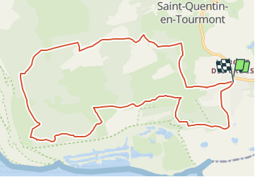
Trail Walking of 11.9 km to be discovered at Hauts-de-France, Somme, Saint-Quentin-en-Tourmont. This trail is proposed by raymondfn.
Description
Randonnée autour du domaine du MarquenterreAutour du Marquenterre, une boucle dans les dunes, les crocs en picard, paradis des oiseaux et royaume du cheval.
Positioning
Country:
France
Region :
Hauts-de-France
Department/Province :
Somme
Municipality :
Saint-Quentin-en-Tourmont
Location:
Unknown
Start:(Dec)
Start:(UTM)
400253 ; 5569606 (31U) N.
Comments