


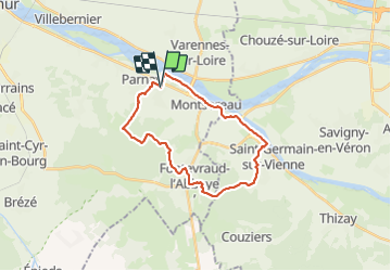
turquant circuit vtt et équestre
L'Anjou en rando
Découvrir ou redécouvrir l'Anjou

Length
23 km

Max alt
118 m

Uphill gradient
310 m
Km-Effort
27 km

Min alt
27 m

Downhill gradient
311 m
Boucle
Yes
Creation date :
2021-06-20 03:52:04.65
Updated on :
2021-06-20 07:54:59.319
3h52
Difficulty : Difficult

FREE GPS app for hiking
 SityTrail
IGN / Geographical institutes
SityTrail Plus
The world is yours!
About
Trail Walking of 23 km to be discovered at Pays de la Loire, Maine-et-Loire, Turquant. This trail is proposed by L'Anjou en rando.
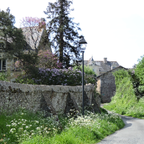
Photos

Positioning
Country:
France
Region :
Pays de la Loire
Department/Province :
Maine-et-Loire
Municipality :
Turquant
Location:
Unknown
Start:(Dec)
Start:(UTM)
275077 ; 5234296 (31T) N.
Comments