


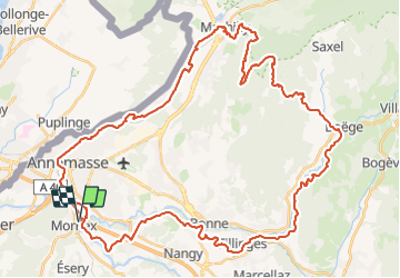
MONNETIER LES VOIRONS RETOUR MENOGE

leclaude74
User


4h17
Difficulty : Difficult

FREE GPS app for hiking
 SityTrail
IGN / Geographical institutes
SityTrail Plus
The world is yours!
About
Trail Mountain bike of 58 km to be discovered at Auvergne-Rhône-Alpes, Upper Savoy, Monnetier-Mornex. This trail is proposed by leclaude74.
Description
BELLE BOUCLE OU L'ON PEUT PARTIR DU PARKING DE LA MIGROS ETREMBIERES DIRECTION MACHILLY POUR MONTER SUR LES VOIRONS / BOEGE /RETOUR MENOGE .
DEPART EN VILLE POUR REJOINDRE LE STADE DE VILLE LA GRAND ET APRES C EST LE TOP!
Photos

Positioning
Comments