


20210622 Arches

Childebert
User
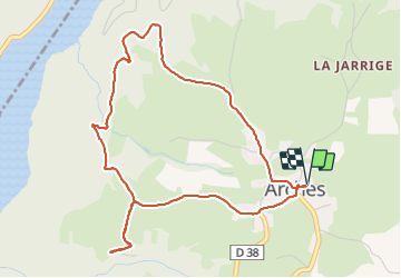

Length
5.3 km

Max alt
598 m

Uphill gradient
128 m
Km-Effort
7 km

Min alt
497 m

Downhill gradient
127 m
Boucle
Yes
Creation date :
2021-06-22 09:01:07.636
Updated on :
2021-06-22 12:06:45.742
2h22
Difficulty : Easy

FREE GPS app for hiking
 SityTrail
IGN / Geographical institutes
SityTrail Plus
The world is yours!
About
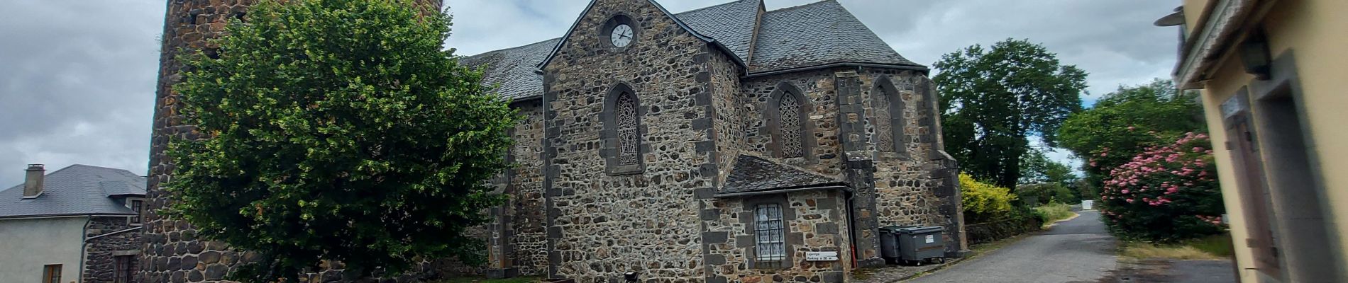
Trail Walking of 5.3 km to be discovered at Auvergne-Rhône-Alpes, Cantal, Arches. This trail is proposed by Childebert.
Photos


Positioning
Country:
France
Region :
Auvergne-Rhône-Alpes
Department/Province :
Cantal
Municipality :
Arches
Location:
Unknown
Start:(Dec)
Start:(UTM)
447406 ; 5017211 (31T) N.
Comments