


AUTOUR DE SERICHAMPS

surceneux
User

Length
8 km

Max alt
1120 m

Uphill gradient
288 m
Km-Effort
11.8 km

Min alt
910 m

Downhill gradient
287 m
Boucle
Yes
Creation date :
2021-06-22 13:33:50.944
Updated on :
2021-06-22 18:28:03.316
2h00
Difficulty : Easy

FREE GPS app for hiking
 SityTrail
IGN / Geographical institutes
SityTrail Plus
The world is yours!
About
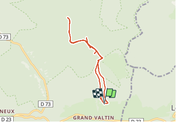
Trail Walking of 8 km to be discovered at Grand Est, Vosges, Ban-sur-Meurthe-Clefcy. This trail is proposed by surceneux.
Description
DEPART CERCLE BLEU PUIS HORS SENTIER BALISETETE DES PORCS INACCESSIBLE LES 4 PLACES RETOUR POINT DEPART
Positioning
Country:
France
Region :
Grand Est
Department/Province :
Vosges
Municipality :
Ban-sur-Meurthe-Clefcy
Location:
Unknown
Start:(Dec)
Start:(UTM)
350739 ; 5329289 (32U) N.
Comments