


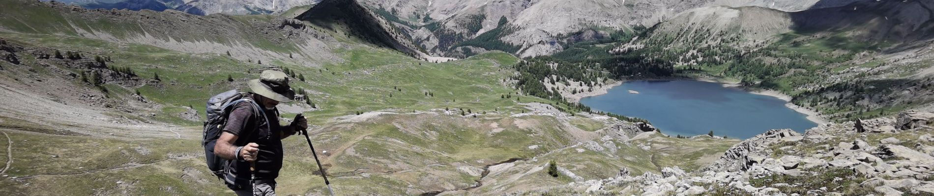
Clignon_l'Encobrette_lac d'Allos

bernir
User
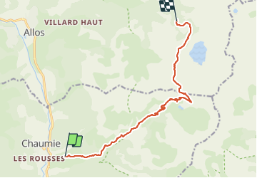

Length
12.8 km

Max alt
2543 m

Uphill gradient
1061 m
Km-Effort
25 km

Min alt
1489 m

Downhill gradient
444 m
Boucle
No
Creation date :
2021-06-25 07:10:23.424
Updated on :
2021-06-28 17:00:40.884
7h00
Difficulty : Difficult

FREE GPS app for hiking
 SityTrail
IGN / Geographical institutes
SityTrail Plus
The world is yours!
About
Trail Walking of 12.8 km to be discovered at Provence-Alpes-Côte d'Azur, Alpes-de-Haute-Provence, Colmars. This trail is proposed by bernir.
Photos


Positioning
Country:
France
Region :
Provence-Alpes-Côte d'Azur
Department/Province :
Alpes-de-Haute-Provence
Municipality :
Colmars
Location:
Unknown
Start:(Dec)
Start:(UTM)
311733 ; 4896564 (32T) N.
Comments