


la Bérarde/source du Vénéon version courte

geoffrayLayeux
User
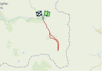

Length
14.9 km

Max alt
2160 m

Uphill gradient
490 m
Km-Effort
21 km

Min alt
1714 m

Downhill gradient
490 m
Boucle
Yes
Creation date :
2021-06-26 11:10:40.591
Updated on :
2021-06-26 11:12:07.299
4h51
Difficulty : Very difficult

FREE GPS app for hiking
 SityTrail
IGN / Geographical institutes
SityTrail Plus
The world is yours!
About
Trail Walking of 14.9 km to be discovered at Auvergne-Rhône-Alpes, Isère, Saint-Christophe-en-Oisans. This trail is proposed by geoffrayLayeux.
Positioning
Country:
France
Region :
Auvergne-Rhône-Alpes
Department/Province :
Isère
Municipality :
Saint-Christophe-en-Oisans
Location:
Unknown
Start:(Dec)
Start:(UTM)
286396 ; 4979019 (32T) N.
Comments