


col de st jurs_montdenier

bernir
User
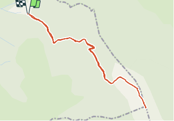

Length
5.7 km

Max alt
1733 m

Uphill gradient
405 m
Km-Effort
11.1 km

Min alt
1317 m

Downhill gradient
411 m
Boucle
Yes
Creation date :
2021-06-26 08:16:19.828
Updated on :
2021-06-28 17:22:14.086
4h18
Difficulty : Medium

FREE GPS app for hiking
 SityTrail
IGN / Geographical institutes
SityTrail Plus
The world is yours!
About
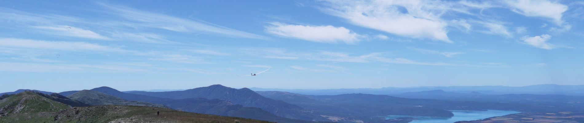
Trail Walking of 5.7 km to be discovered at Provence-Alpes-Côte d'Azur, Alpes-de-Haute-Provence, Saint-Jurs. This trail is proposed by bernir.
Photos


Positioning
Country:
France
Region :
Provence-Alpes-Côte d'Azur
Department/Province :
Alpes-de-Haute-Provence
Municipality :
Saint-Jurs
Location:
Unknown
Start:(Dec)
Start:(UTM)
277918 ; 4865558 (32T) N.
Comments