


canalette

lablaquiere
User
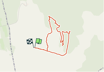

Length
4.6 km

Max alt
736 m

Uphill gradient
73 m
Km-Effort
5.6 km

Min alt
679 m

Downhill gradient
73 m
Boucle
Yes
Creation date :
2021-06-27 14:45:13.1
Updated on :
2021-06-27 16:39:22.833
1h53
Difficulty : Easy

FREE GPS app for hiking
 SityTrail
IGN / Geographical institutes
SityTrail Plus
The world is yours!
About
Trail Walking of 4.6 km to be discovered at Occitania, Aveyron, Nant. This trail is proposed by lablaquiere.
Positioning
Country:
France
Region :
Occitania
Department/Province :
Aveyron
Municipality :
Nant
Location:
Unknown
Start:(Dec)
Start:(UTM)
519563 ; 4868916 (31T) N.
Comments