


Vallon de Combau

kephas
User
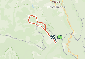

Length
12.2 km

Max alt
1946 m

Uphill gradient
556 m
Km-Effort
19.6 km

Min alt
1459 m

Downhill gradient
552 m
Boucle
Yes
Creation date :
2021-06-28 08:43:31.581
Updated on :
2021-06-28 16:00:59.509
5h03
Difficulty : Medium

FREE GPS app for hiking
 SityTrail
IGN / Geographical institutes
SityTrail Plus
The world is yours!
About
Trail Walking of 12.2 km to be discovered at Auvergne-Rhône-Alpes, Drôme, Châtillon-en-Diois. This trail is proposed by kephas.
Description
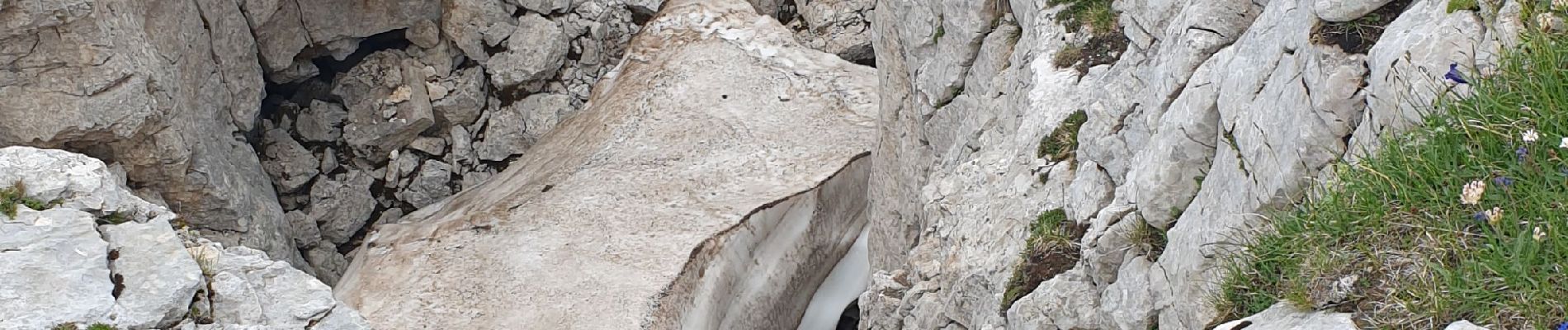
Paysages superbes
Photos


Positioning
Country:
France
Region :
Auvergne-Rhône-Alpes
Department/Province :
Drôme
Municipality :
Châtillon-en-Diois
Location:
Treschenu-Creyers
Start:(Dec)
Start:(UTM)
703650 ; 4961176 (31T) N.
Comments