Trail Walking Saint-Étienne-Vallée-Française - col saint pierre table d orientation - Photo

col saint pierre table d orientation

© OpenStreetMap contributors
Length
Length
1.1 km
Max alt
Max alt
677 m
Uphill gradient
Uphill gradient
74 m
Km-Effort
Km-Effort  
2.1 km
Min alt
Min alt
600 m
Downhill gradient
Downhill gradient
75 m
Boucle
Boucle
Yes
Creation date :
2021-06-29 13:19:10.212
Updated on :
2021-06-29 14:07:24.1

(0 Reviews)

Walking
Walking
46m
Difficulty : Easy

Scan this QR Code to open this trail in the SityTrail application

FREE GPS app for hiking

Logo SityTrail SityTrail

IGN / Geographical institutes

Download SityTrail from the App Store Download SityTrail from Google Play

Logo SityTrail SityTrail World

The world is yours!

Download SityTrail from the App Store Download SityTrail from Google Play Download SityTrail on Huawei AppGallery

About

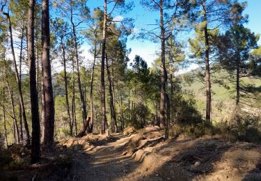
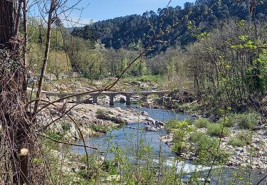
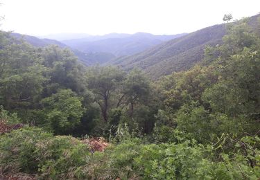
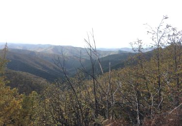
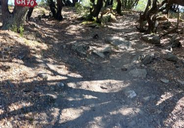
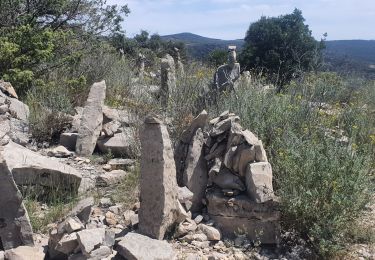
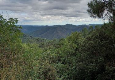
Trail Walking of 1.1 km to be discovered at Occitania, Lozère, Saint-Étienne-Vallée-Française. This trail is proposed by jean-marie.parachini.

Description

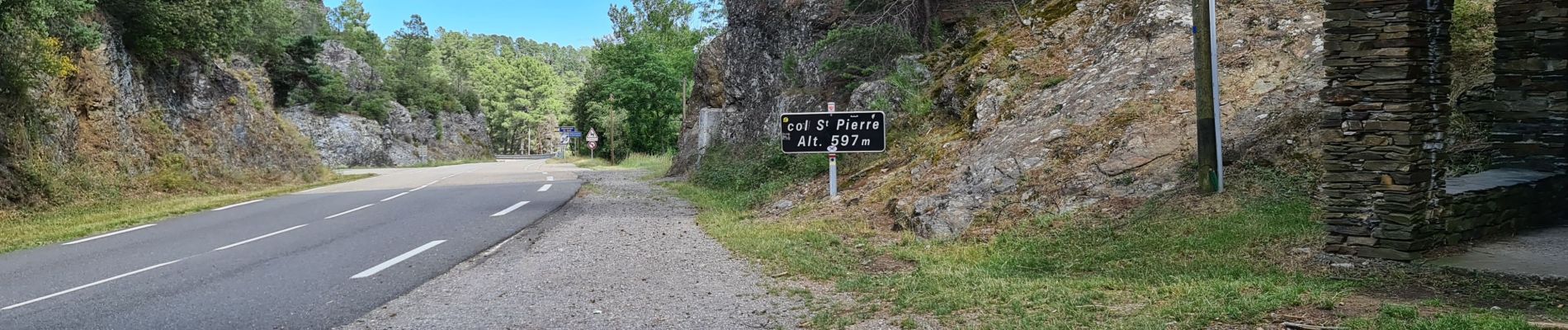
sur la corniche des cevennes, au col saint pierre, accéder à la table d orientation.

Elevation profile

Photos

Positioning

Country:
France
Region :
Occitania
Department/Province :
Lozère
Municipality :
Saint-Étienne-Vallée-Française
Location:
Unknown
Start:(UTM)
567133 ; 4887240 (31T) N.

Trails nearby

Trail Walking Saint-Jean-du-Gard - rocher des chèvres - Photo
Walking
campingmasdelacam

Walking

Medium
(1)
Saint-Jean-du-Gard, Occitania, Gard, France
4 km | 8.4 km-effort
55min
Yes
Trail Walking Saint-Jean-du-Gard - Signal Saint Pierre  - Photo
Walking
GUIDE
nadinebondoux

Walking

Medium
Saint-Jean-du-Gard, Occitania, Gard, France
17.7 km | 26 km-effort
4h 44min
No
Trail Walking Peyrolles - la Diligence  - Photo
Walking
GUIDE
nadinebondoux

Walking

Medium
Peyrolles, Occitania, Gard, France
15.3 km | 0 m-effort
4h 47min
Yes
Trail Walking L'Estréchure - sentier du soult -  - Photo
Walking
campingmasdelacam

Walking

Difficult
L'Estréchure, Occitania, Gard, France
10.3 km | 17.1 km-effort
3h 52min
Yes
Trail Walking Saint-Jean-du-Gard - visite st jean du gard et de son train en attendant le bus pour Ales 1.50  - Photo
Walking
Nathalie. Mercier

Walking

Very easy
Saint-Jean-du-Gard, Occitania, Gard, France
3.8 km | 4.2 km-effort
1h 5min
No
Trail Walking Saint-Étienne-Vallée-Française - Etape 10 St Étienne vallée française/St Jean du gard  - Photo
Walking
Nathalie. Mercier

Walking

Difficult
Saint-Étienne-Vallée-Française, Occitania, Lozère, France
15 km | 23 km-effort
4h 37min
No
Trail Walking Saint-Jean-du-Gard - 17-05-2023 E12 Saint Jean du Gard - Ales  - Photo
Walking
GUIDE
Kargil

Walking

Very difficult
Saint-Jean-du-Gard, Occitania, Gard, France
30 km | 44 km-effort
10h 1min
No
Trail On foot Saint-Étienne-Vallée-Française - Sentier d'Auriol - Photo
On foot
PRO

On foot

Easy
Saint-Étienne-Vallée-Française, Occitania, Lozère, France
9.3 km | 14 km-effort
3h 11min
Yes
Trail Walking Saint-Jean-du-Gard - Col St Pierre,  sentier d 'Auriol - Photo
Walking
GUIDE
nadinebondoux

Walking

Difficult
Saint-Jean-du-Gard, Occitania, Gard, France
22 km | 34 km-effort
7h 2min
Yes


Close
My subscriptions