


SityTrail - fregate

affinetataille
User GUIDE

Length
8.7 km

Max alt
153 m

Uphill gradient
201 m
Km-Effort
11.4 km

Min alt
37 m

Downhill gradient
202 m
Boucle
Yes
Creation date :
2021-06-29 18:09:31.417
Updated on :
2021-07-02 12:31:28.226
3h15
Difficulty : Easy

FREE GPS app for hiking
 SityTrail
IGN / Geographical institutes
SityTrail Plus
The world is yours!
About
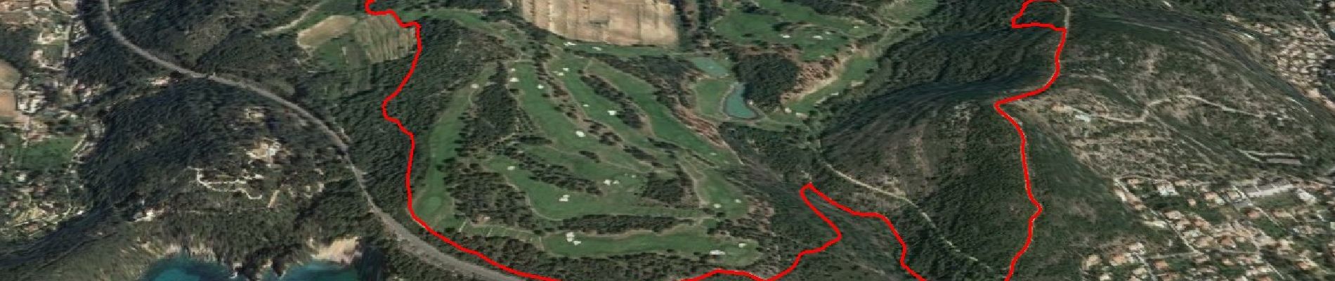
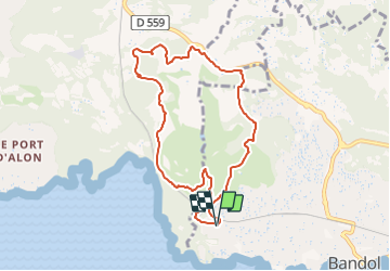
Trail Walking of 8.7 km to be discovered at Provence-Alpes-Côte d'Azur, Var, Bandol. This trail is proposed by affinetataille.
Description
Petite balade facile autour du Golf de La Frégate ....
Photos


28 photos in total. Please click on a photo to see them all in the gallery.
Positioning
Country:
France
Region :
Provence-Alpes-Côte d'Azur
Department/Province :
Var
Municipality :
Bandol
Location:
Unknown
Start:(Dec)
Start:(UTM)
722066 ; 4779987 (31T) N.
Comments