


SityTrail - 2021-06-30 Centre Aéré Saint Ex - Sortie longue

Lucquiaud
User
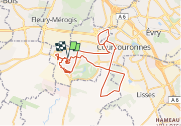

Length
19.1 km

Max alt
94 m

Uphill gradient
131 m
Km-Effort
21 km

Min alt
73 m

Downhill gradient
131 m
Boucle
Yes
Creation date :
2021-06-30 08:47:30.669
Updated on :
2021-07-03 09:03:20.245
1h26
Difficulty : Medium

FREE GPS app for hiking
 SityTrail
IGN / Geographical institutes
SityTrail Plus
The world is yours!
About
Trail Mountain bike of 19.1 km to be discovered at Ile-de-France, Essonne, Bondoufle. This trail is proposed by Lucquiaud.
Positioning
Country:
France
Region :
Ile-de-France
Department/Province :
Essonne
Municipality :
Bondoufle
Location:
Unknown
Start:(Dec)
Start:(UTM)
453607 ; 5384601 (31U) N.
Comments