


BOUCLE COL DU PRANLET

issartelserge
User
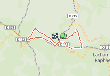

Length
7.2 km

Max alt
1484 m

Uphill gradient
219 m
Km-Effort
10.1 km

Min alt
1303 m

Downhill gradient
215 m
Boucle
Yes
Creation date :
2021-07-01 07:19:28.0
Updated on :
2021-08-25 07:08:50.243
3h04
Difficulty : Medium

FREE GPS app for hiking
 SityTrail
IGN / Geographical institutes
SityTrail Plus
The world is yours!
About
Trail Walking of 7.2 km to be discovered at Auvergne-Rhône-Alpes, Ardèche, Saint-Andéol-de-Fourchades. This trail is proposed by issartelserge.
Description
Moyenne
Positioning
Country:
France
Region :
Auvergne-Rhône-Alpes
Department/Province :
Ardèche
Municipality :
Saint-Andéol-de-Fourchades
Location:
Unknown
Start:(Dec)
Start:(UTM)
600056 ; 4963255 (31T) N.
Comments