


LAC BLANC

surceneux
User

Length
45 km

Max alt
1237 m

Uphill gradient
974 m
Km-Effort
58 km

Min alt
699 m

Downhill gradient
972 m
Boucle
Yes
Creation date :
2021-07-02 06:31:24.83
Updated on :
2021-07-02 10:35:49.862
3h00
Difficulty : Easy

FREE GPS app for hiking
 SityTrail
IGN / Geographical institutes
SityTrail Plus
The world is yours!
About
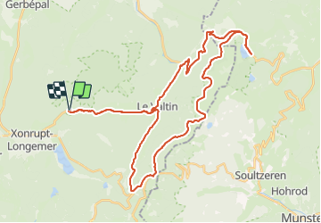
Trail Mountain bike of 45 km to be discovered at Grand Est, Vosges, Ban-sur-Meurthe-Clefcy. This trail is proposed by surceneux.
Description
SURCENEUX LE VALTIN RF RUDLIN COL DU LOUCHBACH COL DU CALVAIRE LAC BLANC RTE DES CRETES LA SCHLUCHT LE COLLET ROUTE DE LA COMBE SURCENEUX
Positioning
Country:
France
Region :
Grand Est
Department/Province :
Vosges
Municipality :
Ban-sur-Meurthe-Clefcy
Location:
Unknown
Start:(Dec)
Start:(UTM)
347840 ; 5329039 (32U) N.
Comments