


Camprieu

ARVIEU
User

Length
16.5 km

Max alt
1291 m

Uphill gradient
526 m
Km-Effort
24 km

Min alt
891 m

Downhill gradient
526 m
Boucle
Yes
Creation date :
2021-07-02 15:40:40.416
Updated on :
2021-07-02 15:41:36.295
5h20
Difficulty : Medium

FREE GPS app for hiking
 SityTrail
IGN / Geographical institutes
SityTrail Plus
The world is yours!
About
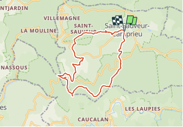
Trail Walking of 16.5 km to be discovered at Occitania, Gard, Saint-Sauveur-Camprieu. This trail is proposed by ARVIEU.
Positioning
Country:
France
Region :
Occitania
Department/Province :
Gard
Municipality :
Saint-Sauveur-Camprieu
Location:
Unknown
Start:(Dec)
Start:(UTM)
538085 ; 4884619 (31T) N.
Comments