


Belledonne les 7 Laux sud

c.gourme
User
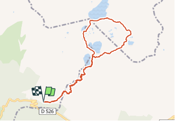

Length
12.1 km

Max alt
2369 m

Uphill gradient
1117 m
Km-Effort
27 km

Min alt
1255 m

Downhill gradient
1117 m
Boucle
Yes
Creation date :
2021-07-01 07:08:48.0
Updated on :
2021-07-03 05:20:10.816
7h09
Difficulty : Difficult

FREE GPS app for hiking
 SityTrail
IGN / Geographical institutes
SityTrail Plus
The world is yours!
About
Trail Walking of 12.1 km to be discovered at Auvergne-Rhône-Alpes, Isère, Allemond. This trail is proposed by c.gourme.
Description
Pente très raide au début
Positioning
Country:
France
Region :
Auvergne-Rhône-Alpes
Department/Province :
Isère
Municipality :
Allemond
Location:
Unknown
Start:(Dec)
Start:(UTM)
269106 ; 5010539 (32T) N.
Comments