


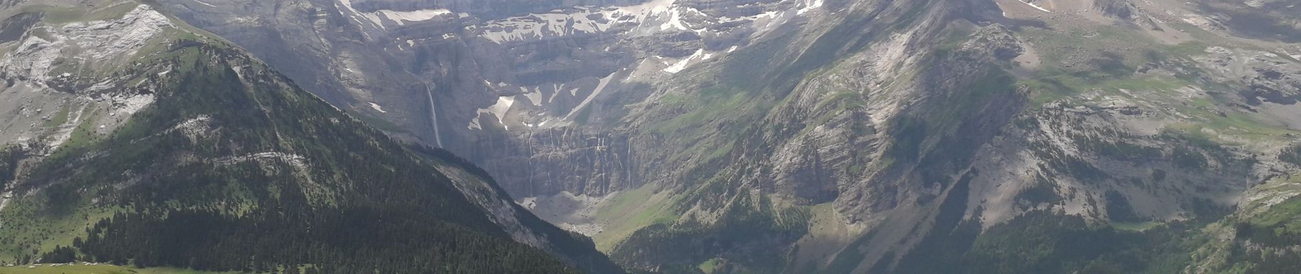
Pyrénées cirque de Gavarnie retour par refuge Espuguettes

ericf64
User
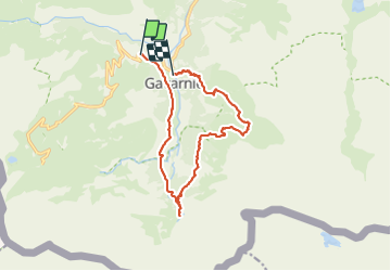

Length
14.1 km

Max alt
2045 m

Uphill gradient
821 m
Km-Effort
25 km

Min alt
1373 m

Downhill gradient
922 m
Boucle
No
Creation date :
2021-07-03 05:46:04.802
Updated on :
2021-07-03 11:42:25.53
5h54
Difficulty : Medium

FREE GPS app for hiking
 SityTrail
IGN / Geographical institutes
SityTrail Plus
The world is yours!
About
Trail Walking of 14.1 km to be discovered at Occitania, Hautespyrenees, Gavarnie-Gèdre. This trail is proposed by ericf64.
Photos

Positioning
Country:
France
Region :
Occitania
Department/Province :
Hautespyrenees
Municipality :
Gavarnie-Gèdre
Location:
Gavarnie
Start:(Dec)
Start:(UTM)
743932 ; 4736106 (30T) N.
Comments