


St Vincent Pierre chauve Tourniol

nordan
User
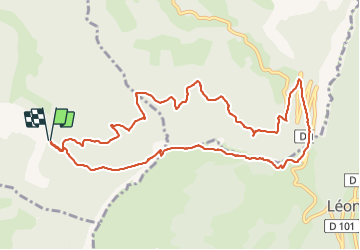

Length
11.9 km

Max alt
1299 m

Uphill gradient
856 m
Km-Effort
23 km

Min alt
612 m

Downhill gradient
858 m
Boucle
Yes
Creation date :
2021-07-03 08:02:18.526
Updated on :
2021-07-03 12:43:37.121
4h40
Difficulty : Medium

FREE GPS app for hiking
 SityTrail
IGN / Geographical institutes
SityTrail Plus
The world is yours!
About
Trail Walking of 11.9 km to be discovered at Auvergne-Rhône-Alpes, Drôme, Saint-Vincent-la-Commanderie. This trail is proposed by nordan.
Positioning
Country:
France
Region :
Auvergne-Rhône-Alpes
Department/Province :
Drôme
Municipality :
Saint-Vincent-la-Commanderie
Location:
Unknown
Start:(Dec)
Start:(UTM)
668921 ; 4976230 (31T) N.
Comments