


Lac de l'Oule - refuge de Bastan

frizou83
User
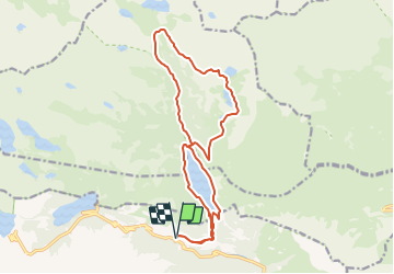

Length
18.4 km

Max alt
2321 m

Uphill gradient
885 m
Km-Effort
30 km

Min alt
1594 m

Downhill gradient
885 m
Boucle
Yes
Creation date :
2021-07-04 18:48:13.868
Updated on :
2021-07-04 18:48:43.479
6h51
Difficulty : Difficult

FREE GPS app for hiking
 SityTrail
IGN / Geographical institutes
SityTrail Plus
The world is yours!
About
Trail Walking of 18.4 km to be discovered at Occitania, Hautespyrenees, Aragnouet. This trail is proposed by frizou83.
Positioning
Country:
France
Region :
Occitania
Department/Province :
Hautespyrenees
Municipality :
Aragnouet
Location:
Unknown
Start:(Dec)
Start:(UTM)
270602 ; 4744510 (31T) N.
Comments