


Marcelle en villette

jcpinon
User
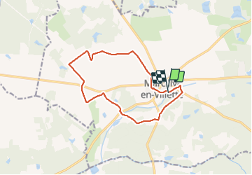

Length
12.5 km

Max alt
133 m

Uphill gradient
72 m
Km-Effort
13.4 km

Min alt
109 m

Downhill gradient
77 m
Boucle
Yes
Creation date :
2021-07-07 07:07:42.555
Updated on :
2021-07-07 10:14:09.032
3h05
Difficulty : Easy

FREE GPS app for hiking
 SityTrail
IGN / Geographical institutes
SityTrail Plus
The world is yours!
About
Trail Walking of 12.5 km to be discovered at Centre-Loire Valley, Loiret, Marcilly-en-Villette. This trail is proposed by jcpinon.
Positioning
Country:
France
Region :
Centre-Loire Valley
Department/Province :
Loiret
Municipality :
Marcilly-en-Villette
Location:
Unknown
Start:(Dec)
Start:(UTM)
426874 ; 5290397 (31T) N.
Comments