


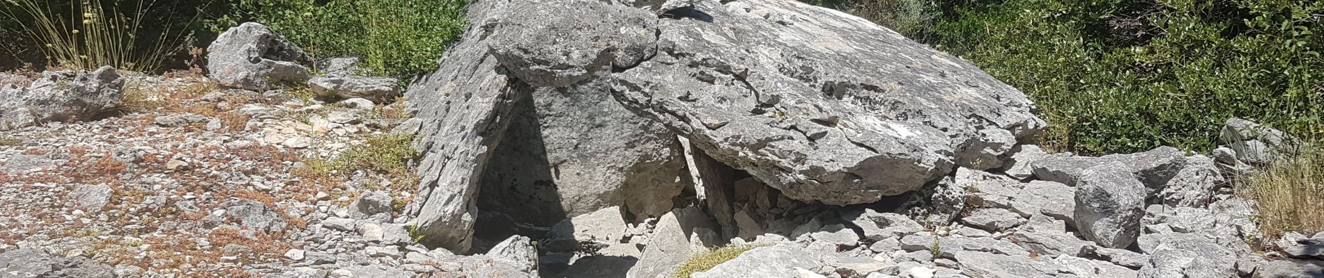
barjac dolmens avens

Dan30
User
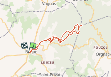

Length
17.4 km

Max alt
368 m

Uphill gradient
319 m
Km-Effort
22 km

Min alt
146 m

Downhill gradient
320 m
Boucle
Yes
Creation date :
2021-07-07 06:50:28.051
Updated on :
2021-07-07 13:06:52.341
5h21
Difficulty : Easy

FREE GPS app for hiking
 SityTrail
IGN / Geographical institutes
SityTrail Plus
The world is yours!
About
Trail Walking of 17.4 km to be discovered at Occitania, Gard, Barjac. This trail is proposed by Dan30.
Photos


Positioning
Country:
France
Region :
Occitania
Department/Province :
Gard
Municipality :
Barjac
Location:
Unknown
Start:(Dec)
Start:(UTM)
607197 ; 4906845 (31T) N.
Comments