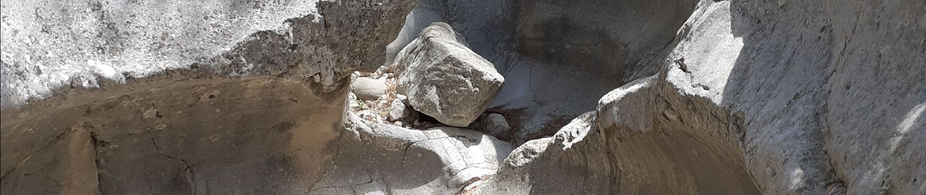
Gorges de Destel

cousam
User

Length
6.8 km

Max alt
376 m

Uphill gradient
346 m
Km-Effort
11.5 km

Min alt
52 m

Downhill gradient
370 m
Boucle
No
Creation date :
2021-07-07 10:39:37.336
Updated on :
2021-07-07 15:54:23.037
3h50
Difficulty : Difficult

FREE GPS app for hiking
 SityTrail
IGN / Geographical institutes
SityTrail Plus
The world is yours!
About
Trail Walking of 6.8 km to be discovered at Provence-Alpes-Côte d'Azur, Var, Ollioules. This trail is proposed by cousam.
Description
Sortie au panneau "fontaine de joncs"(cause grosse chaleur un 7 juillet) on peut continuer jusqu'au "dauphin" peint sur le rocher pour sortir, avec une chaine pour sortir sur le plateau.
Photos


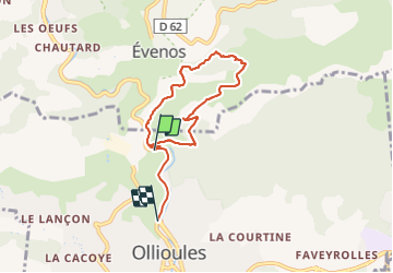
Positioning
Country:
France
Region :
Provence-Alpes-Côte d'Azur
Department/Province :
Var
Municipality :
Ollioules
Location:
Unknown
Start:(Dec)
Start:(UTM)
731408 ; 4781580 (31T) N.
Comments