


Queyras jour 9

chasle
User
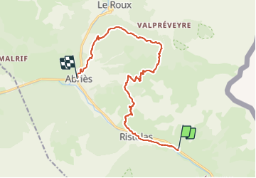

Length
15.1 km

Max alt
2373 m

Uphill gradient
789 m
Km-Effort
26 km

Min alt
1554 m

Downhill gradient
873 m
Boucle
No
Creation date :
2021-07-08 03:36:47.948
Updated on :
2021-07-08 09:50:01.431
5h01
Difficulty : Difficult

FREE GPS app for hiking
 SityTrail
IGN / Geographical institutes
SityTrail Plus
The world is yours!
About
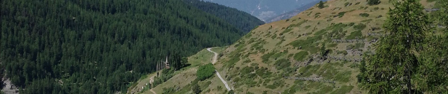
Trail Walking of 15.1 km to be discovered at Provence-Alpes-Côte d'Azur, Hautes-Alpes, Abriès-Ristolas. This trail is proposed by chasle.
Photos


Positioning
Country:
France
Region :
Provence-Alpes-Côte d'Azur
Department/Province :
Hautes-Alpes
Municipality :
Abriès-Ristolas
Location:
Ristolas
Start:(Dec)
Start:(UTM)
339856 ; 4959400 (32T) N.
Comments