


rando puyselci du 09/07/2021

dudu79
User
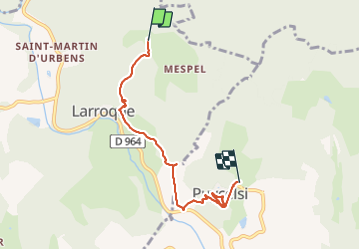

Length
5.3 km

Max alt
295 m

Uphill gradient
244 m
Km-Effort
8.5 km

Min alt
140 m

Downhill gradient
228 m
Boucle
No
Creation date :
2021-07-09 11:18:55.351
Updated on :
2021-07-09 13:52:42.843
1h43
Difficulty : Medium

FREE GPS app for hiking
 SityTrail
IGN / Geographical institutes
SityTrail Plus
The world is yours!
About
Trail Walking of 5.3 km to be discovered at Occitania, Tarn, Larroque. This trail is proposed by dudu79.
Description
avec Jean Marc et Catherine.
Positioning
Country:
France
Region :
Occitania
Department/Province :
Tarn
Municipality :
Larroque
Location:
Unknown
Start:(Dec)
Start:(UTM)
395621 ; 4874063 (31T) N.
Comments