


étape 6 echalp col vieux

Bernadette Noirant
User
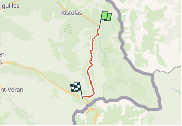

Length
11.6 km

Max alt
2806 m

Uphill gradient
1166 m
Km-Effort
24 km

Min alt
1696 m

Downhill gradient
302 m
Boucle
No
Creation date :
2021-07-10 06:59:57.242
Updated on :
2021-07-10 14:40:04.065
4h52
Difficulty : Very easy

FREE GPS app for hiking
 SityTrail
IGN / Geographical institutes
SityTrail Plus
The world is yours!
About
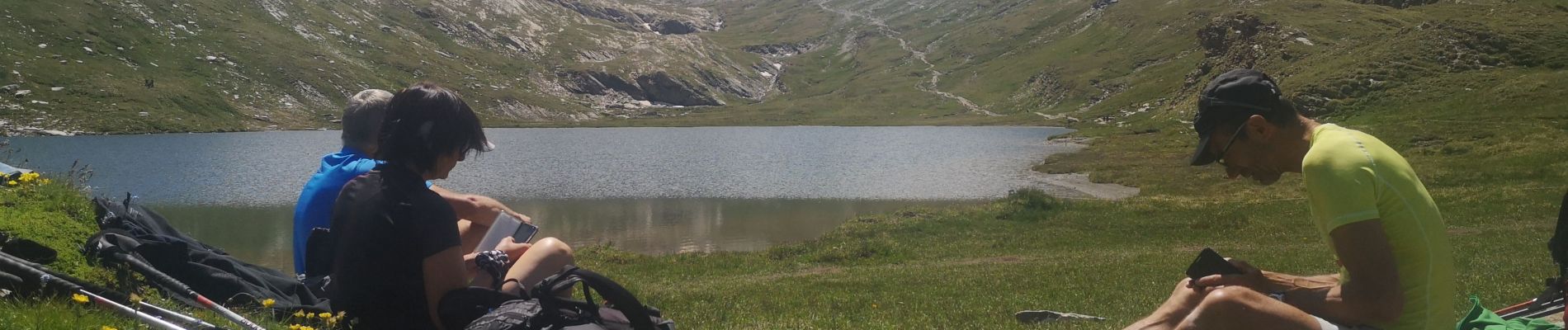
Trail Walking of 11.6 km to be discovered at Provence-Alpes-Côte d'Azur, Hautes-Alpes, Abriès-Ristolas. This trail is proposed by Bernadette Noirant.
Photos


Positioning
Country:
France
Region :
Provence-Alpes-Côte d'Azur
Department/Province :
Hautes-Alpes
Municipality :
Abriès-Ristolas
Location:
Ristolas
Start:(Dec)
Start:(UTM)
341194 ; 4958186 (32T) N.
Comments