


Ottrott mont sainte odile

taguette
User

Length
17.9 km

Max alt
834 m

Uphill gradient
678 m
Km-Effort
27 km

Min alt
285 m

Downhill gradient
679 m
Boucle
Yes
Creation date :
2021-07-11 06:10:12.117
Updated on :
2021-07-11 11:04:25.046
4h47
Difficulty : Very difficult

FREE GPS app for hiking
 SityTrail
IGN / Geographical institutes
SityTrail Plus
The world is yours!
About
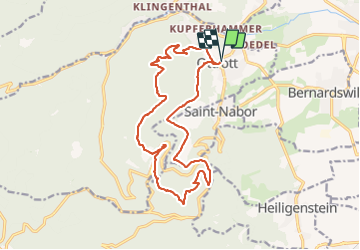
Trail Walking of 17.9 km to be discovered at Grand Est, Bas-Rhin, Ottrott. This trail is proposed by taguette.
Positioning
Country:
France
Region :
Grand Est
Department/Province :
Bas-Rhin
Municipality :
Ottrott
Location:
Unknown
Start:(Dec)
Start:(UTM)
383548 ; 5368335 (32U) N.
Comments