


Pic d'Arneille

frizou83
User
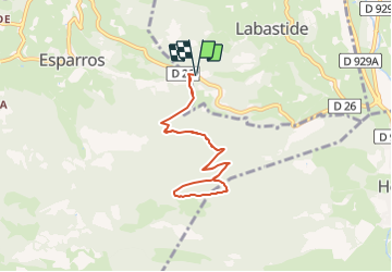

Length
7.7 km

Max alt
1267 m

Uphill gradient
563 m
Km-Effort
15.2 km

Min alt
720 m

Downhill gradient
563 m
Boucle
Yes
Creation date :
2021-07-12 14:53:35.156
Updated on :
2021-07-12 14:54:11.159
3h26
Difficulty : Difficult

FREE GPS app for hiking
 SityTrail
IGN / Geographical institutes
SityTrail Plus
The world is yours!
About
Trail Walking of 7.7 km to be discovered at Occitania, Hautespyrenees, Labastide. This trail is proposed by frizou83.


Positioning
Country:
France
Region :
Occitania
Department/Province :
Hautespyrenees
Municipality :
Labastide
Location:
Unknown
Start:(Dec)
Start:(UTM)
283345 ; 4767602 (31T) N.
Comments