


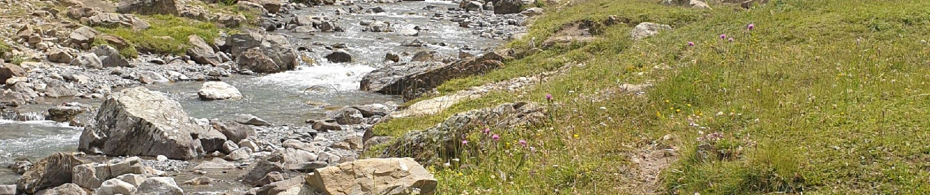
Prapic Le Saut de Laire

kephas
User
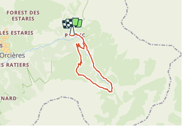

Length
11.8 km

Max alt
2069 m

Uphill gradient
556 m
Km-Effort
19.1 km

Min alt
1533 m

Downhill gradient
532 m
Boucle
No
Creation date :
2021-07-12 07:40:49.807
Updated on :
2021-07-12 22:57:45.462
6h04
Difficulty : Medium

FREE GPS app for hiking
 SityTrail
IGN / Geographical institutes
SityTrail Plus
The world is yours!
About
Trail Walking of 11.8 km to be discovered at Provence-Alpes-Côte d'Azur, Hautes-Alpes, Orcières. This trail is proposed by kephas.
Photos


Positioning
Country:
France
Region :
Provence-Alpes-Côte d'Azur
Department/Province :
Hautes-Alpes
Municipality :
Orcières
Location:
Unknown
Start:(Dec)
Start:(UTM)
291292 ; 4952286 (32T) N.
Comments