


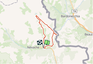
Vtt La tour de l'aiguille rouge

topolino
User

Length
23 km

Max alt
2199 m

Uphill gradient
940 m
Km-Effort
35 km

Min alt
1581 m

Downhill gradient
935 m
Boucle
Yes
Creation date :
2021-07-13 07:38:41.445
Updated on :
2021-07-13 07:39:42.216
--
Difficulty : Unknown

FREE GPS app for hiking
 SityTrail
IGN / Geographical institutes
SityTrail Plus
The world is yours!
About
Trail Mountain bike of 23 km to be discovered at Provence-Alpes-Côte d'Azur, Hautes-Alpes, Névache. This trail is proposed by topolino.
Positioning
Country:
France
Region :
Provence-Alpes-Côte d'Azur
Department/Province :
Hautes-Alpes
Municipality :
Névache
Location:
Unknown
Start:(Dec)
Start:(UTM)
313419 ; 4987571 (32T) N.
Comments