


Queyras jour 7

chasle
User
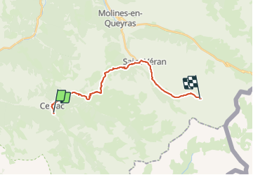

Length
20 km

Max alt
2648 m

Uphill gradient
1623 m
Km-Effort
39 km

Min alt
1636 m

Downhill gradient
880 m
Boucle
No
Creation date :
2021-07-06 03:30:15.014
Updated on :
2021-07-13 14:21:24.255
6h15
Difficulty : Difficult

FREE GPS app for hiking
 SityTrail
IGN / Geographical institutes
SityTrail Plus
The world is yours!
About
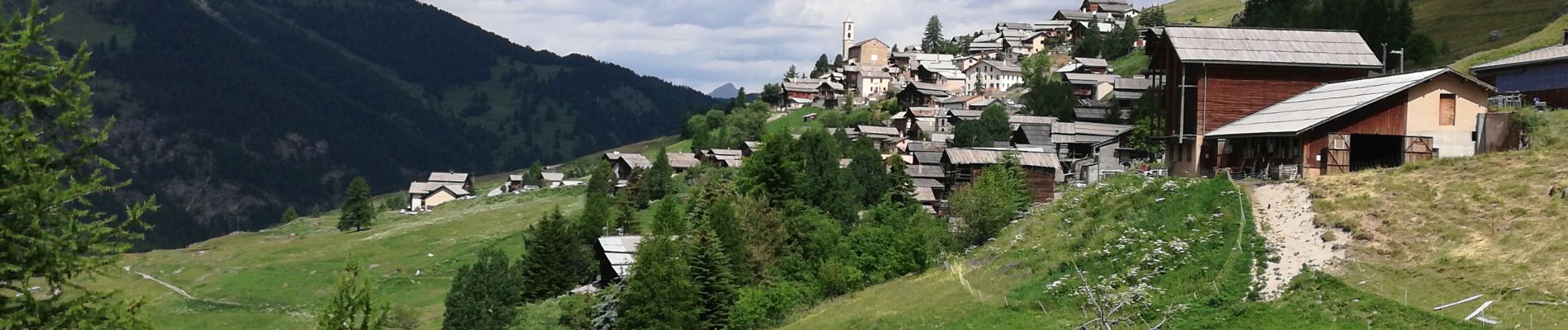
Trail Walking of 20 km to be discovered at Provence-Alpes-Côte d'Azur, Hautes-Alpes, Ceillac. This trail is proposed by chasle.
Photos


Positioning
Country:
France
Region :
Provence-Alpes-Côte d'Azur
Department/Province :
Hautes-Alpes
Municipality :
Ceillac
Location:
Unknown
Start:(Dec)
Start:(UTM)
323997 ; 4948021 (32T) N.
Comments