


refuge Olan / Breche Olan / refuge des souffles

cmolinier
User

Length
25 km

Max alt
2700 m

Uphill gradient
1967 m
Km-Effort
52 km

Min alt
1044 m

Downhill gradient
1965 m
Boucle
Yes
Creation date :
2021-07-14 15:30:12.822
Updated on :
2021-07-14 15:32:38.983
11h44
Difficulty : Very difficult

FREE GPS app for hiking
 SityTrail
IGN / Geographical institutes
SityTrail Plus
The world is yours!
About
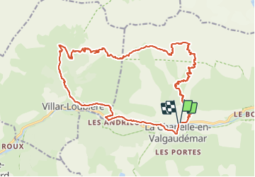
Trail Walking of 25 km to be discovered at Provence-Alpes-Côte d'Azur, Hautes-Alpes, La Chapelle-en-Valgaudémar. This trail is proposed by cmolinier.
Positioning
Country:
France
Region :
Provence-Alpes-Côte d'Azur
Department/Province :
Hautes-Alpes
Municipality :
La Chapelle-en-Valgaudémar
Location:
Unknown
Start:(Dec)
Start:(UTM)
278372 ; 4966821 (32T) N.
Comments