


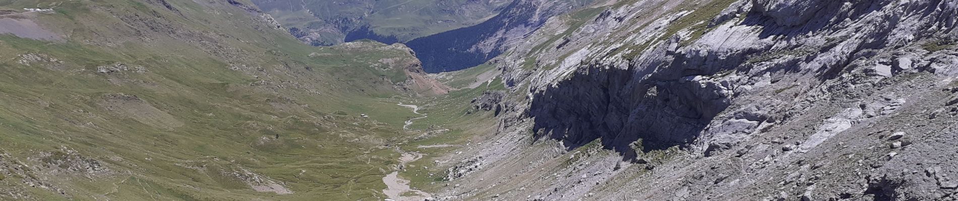
Brèche de Roland A/R depuis le col de Tentes

donda
User GUIDE
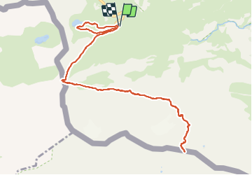

Length
13.5 km

Max alt
2823 m

Uphill gradient
763 m
Km-Effort
24 km

Min alt
2197 m

Downhill gradient
765 m
Boucle
Yes
Creation date :
2021-07-15 06:36:06.661
Updated on :
2021-07-20 12:50:12.396
4h38
Difficulty : Very difficult

FREE GPS app for hiking
 SityTrail
IGN / Geographical institutes
SityTrail Plus
The world is yours!
About
Trail Walking of 13.5 km to be discovered at Occitania, Hautespyrenees, Gavarnie-Gèdre. This trail is proposed by donda.
Description
Avec au retour un petit circuit pour le lac d'Espécières.
Ne pas oublier les crampons.
Photos


Positioning
Country:
France
Region :
Occitania
Department/Province :
Hautespyrenees
Municipality :
Gavarnie-Gèdre
Location:
Gavarnie
Start:(Dec)
Start:(UTM)
741541 ; 4733265 (30T) N.
Comments