


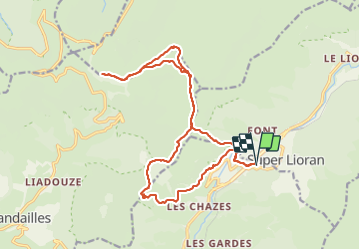
Puy Griou - puy de Peyre Arse - brèche de Roland

mrcat
User

Length
20 km

Max alt
1783 m

Uphill gradient
819 m
Km-Effort
31 km

Min alt
1211 m

Downhill gradient
820 m
Boucle
Yes
Creation date :
2021-07-15 08:12:31.0
Updated on :
2021-07-15 15:00:11.572
6h27
Difficulty : Very difficult

FREE GPS app for hiking
 SityTrail
IGN / Geographical institutes
SityTrail Plus
The world is yours!
About
Trail Walking of 20 km to be discovered at Auvergne-Rhône-Alpes, Cantal, Saint-Jacques-des-Blats. This trail is proposed by mrcat.
Positioning
Country:
France
Region :
Auvergne-Rhône-Alpes
Department/Province :
Cantal
Municipality :
Saint-Jacques-des-Blats
Location:
Unknown
Start:(Dec)
Start:(UTM)
479470 ; 4992095 (31T) N.
Comments