


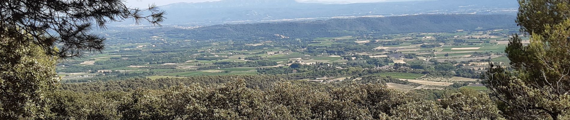
Cucuron Vaugines - Rocher de Curet

counoise
User
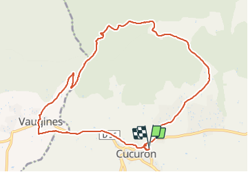

Length
11.6 km

Max alt
630 m

Uphill gradient
327 m
Km-Effort
16 km

Min alt
338 m

Downhill gradient
328 m
Boucle
Yes
Creation date :
2021-07-17 13:54:59.213
Updated on :
2021-07-17 17:28:35.558
2h33
Difficulty : Easy

FREE GPS app for hiking
 SityTrail
IGN / Geographical institutes
SityTrail Plus
The world is yours!
About
Trail Walking of 11.6 km to be discovered at Provence-Alpes-Côte d'Azur, Vaucluse, Cucuron. This trail is proposed by counoise.
Photos

Positioning
Country:
France
Region :
Provence-Alpes-Côte d'Azur
Department/Province :
Vaucluse
Municipality :
Cucuron
Location:
Unknown
Start:(Dec)
Start:(UTM)
696553 ; 4849679 (31T) N.
Comments