Trail Walking Vieux-Moulin - en foret de Compiègne_38_07_2021_sur la Route Eugénie - Photo

en foret de Compiègne_38_07_2021_sur la Route Eugénie

mes randos en forêt

© OpenStreetMap contributors
Length
Length
13.6 km
Max alt
Max alt
101 m
Uphill gradient
Uphill gradient
143 m
Km-Effort
Km-Effort  
15.5 km
Min alt
Min alt
43 m
Downhill gradient
Downhill gradient
142 m
Boucle
Boucle
Yes
Creation date :
2021-07-18 06:38:56.0
Updated on :
2021-10-29 05:46:41.59

(0 Reviews)

Walking
Walking
4h06
Difficulty : Easy

Scan this QR Code to open this trail in the SityTrail application

FREE GPS app for hiking

Logo SityTrail SityTrail

IGN / Geographical institutes

Download SityTrail from the App Store Download SityTrail from Google Play

Logo SityTrail SityTrail World

The world is yours!

Download SityTrail from the App Store Download SityTrail from Google Play Download SityTrail on Huawei AppGallery

About

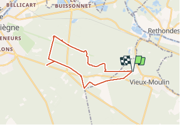
Trail Walking of 13.6 km to be discovered at Hauts-de-France, Oise, Vieux-Moulin. This trail is proposed by en forêt de Compiègne.

Description

07/ 2021

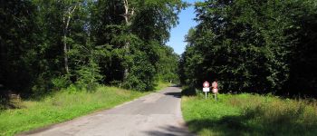
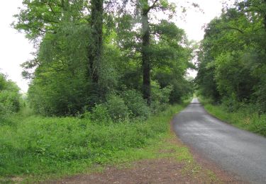
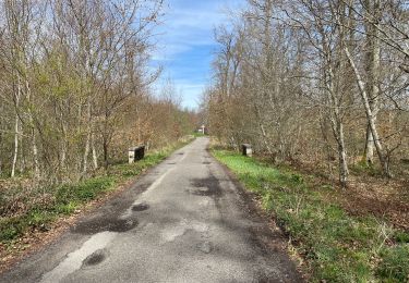
objectifs: faire la Route Eugénie (prévue en hiver car cette route est essentiellement bitumeuse donc pas de boue mais vu la pluie en juillet, la date a été avancée).
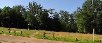
rando facile.

voir aussi: //la-foret-de-compiegne.fr/

batterie de recharge pour iphone nécessaire.
Eviter quand même le dimanche en été par beau temps car beaucoup de monde sur la piste cyclable et l'avenue des Beaux Monts (promeneurs, randonneurs, familles, vtt ...).

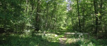
Au départ du Vivier Frère Robert, suivre la Route Eugénie jusqu'au carrefour du Renard en traversant l'Avenue des Beaux Monts. Rejoindre la piste cyclable (Route de la Mare aux Canes), prés du carrefour Gabriel et la suivre jusqu'au carrefour des Sept Morts puis revenir au point de départ .
passage par le carrefour de la Tilloye et le carrefour de Morpigny (bonus).

Elevation profile

Photos

45 photos in total. Please click on a photo to see them all in the gallery.

Points of interest

Point of interest Vieux-Moulin - Point 1 - Photo
JeanLucA4
VIEUX-MOULIN 
Point of interest Vieux-Moulin - Unnamed POI - Photo
JeanLucA4
VIEUX-MOULIN 
Point of interest Compiègne - Unnamed POI - Photo
JeanLucA4
COMPIÈGNE 
Point of interest Compiègne - Unnamed POI - Photo
JeanLucA4
COMPIÈGNE 
Point of interest Compiègne - Unnamed POI - Photo
JeanLucA4
COMPIÈGNE 
Point of interest Compiègne - Unnamed POI - Photo
JeanLucA4
COMPIÈGNE 
Point of interest Compiègne - Unnamed POI - Photo
JeanLucA4
COMPIÈGNE 
Point of interest Compiègne - Unnamed POI - Photo
JeanLucA4
COMPIÈGNE 
Point of interest Compiègne - Point 3 - Photo
JeanLucA4
COMPIÈGNE 
Point of interest Compiègne - Unnamed POI - Photo
JeanLucA4
COMPIÈGNE 
Point of interest Compiègne - Unnamed POI - Photo
JeanLucA4
COMPIÈGNE 
Point of interest Compiègne - Point 2 - Photo
JeanLucA4
COMPIÈGNE 
Point of interest Compiègne - Unnamed POI - Photo
JeanLucA4
COMPIÈGNE 
Point of interest Compiègne - Unnamed POI - Photo
JeanLucA4
COMPIÈGNE 
Point of interest Compiègne - Unnamed POI - Photo
JeanLucA4
COMPIÈGNE 
Point of interest Compiègne - Unnamed POI - Photo
JeanLucA4
COMPIÈGNE 
Point of interest Compiègne - Unnamed POI - Photo
JeanLucA4
COMPIÈGNE 
Point of interest Vieux-Moulin - Unnamed POI - Photo
JeanLucA4
VIEUX-MOULIN 
Point of interest Vieux-Moulin - Unnamed POI - Photo
JeanLucA4
VIEUX-MOULIN 

Positioning

Country:
France
Region :
Hauts-de-France
Department/Province :
Oise
Municipality :
Vieux-Moulin
Location:
Unknown
Start:(UTM)
494081 ; 5471712 (31U) N.

Trails nearby

Trail Walking Choisy-au-Bac - en forêt de Laigue_9_06_2020_Chemin du Fau Bidaud et la Route de Royaumont - Photo
Walking

Walking

Very difficult
(1)
Choisy-au-Bac, Hauts-de-France, Oise, France
9.6 km | 12.8 km-effort
3h 0min
Yes
Trail Walking Rethondes - en forêt de Laigue_4_08_2019_Mont du Fouilleux_Mont des Singes_Marais de Francière - Photo
Walking

Walking

Very difficult
(1)
Rethondes, Hauts-de-France, Oise, France
14.8 km | 17.7 km-effort
4h 49min
Yes
Trail On foot Saint-Jean-aux-Bois - Promenade du Chêne de Saint-Jean - Photo
On foot
PRO

On foot

Easy
Saint-Jean-aux-Bois, Hauts-de-France, Oise, France
5.7 km | 6.5 km-effort
1h 28min
No
Trail Walking Vieux-Moulin - Rando douce Vieux moulin 14/8/2022 - Photo
Walking
pascha

Walking

Medium
(1)
Vieux-Moulin, Hauts-de-France, Oise, France
8.7 km | 10.1 km-effort
2h 14min
Yes
Trail Walking Vieux-Moulin - Gorges du Han - ATPC ARVAL - Photo
Walking
pascha

Walking

Very easy
(1)
Vieux-Moulin, Hauts-de-France, Oise, France
13.2 km | 16 km-effort
2h 42min
Yes
Trail Walking Compiègne - en Forêt de Compiègne_50_les Routes des Beaux Monts, de Morpigny et des Nymphes - Photo
Walking

Walking

Very difficult
Compiègne, Hauts-de-France, Oise, France
17 km | 20 km-effort
5h 2min
Yes
Trail Walking Compiègne - en forêt de Compiègne_48_sur les Routes de la Mariolle et du Grand Veneur - Photo
Walking

Walking

Very difficult
Compiègne, Hauts-de-France, Oise, France
17 km | 19.9 km-effort
5h 21min
Yes
Trail Walking Compiègne - Compiegne rond point de l’Armistice 13,4 km - Photo
Walking
GUIDE
rvapeldo

Walking

Easy
Compiègne, Hauts-de-France, Oise, France
13.4 km | 17.5 km-effort
3h 36min
Yes
Trail Walking Compiègne - en forêt de Compiègne_47_autour des Beaux Monts - Photo
Walking

Walking

Medium
Compiègne, Hauts-de-France, Oise, France
4.8 km | 6.4 km-effort
1h 27min
No


Close
My subscriptions